


FLORIDA — Hurricane Milton is expected to approach from the southwest Wednesday, potentially making landfall somewhere close to Tampa Bay or Sarasota late Wednesday night.
Our worst impacts locally will be felt from 7 p.m. Wednesday into Thursday morning, but timing will adjust with the movement of Milton.
Our Spectrum News 13 Weather Experts have broken down, by county, what to watch for.
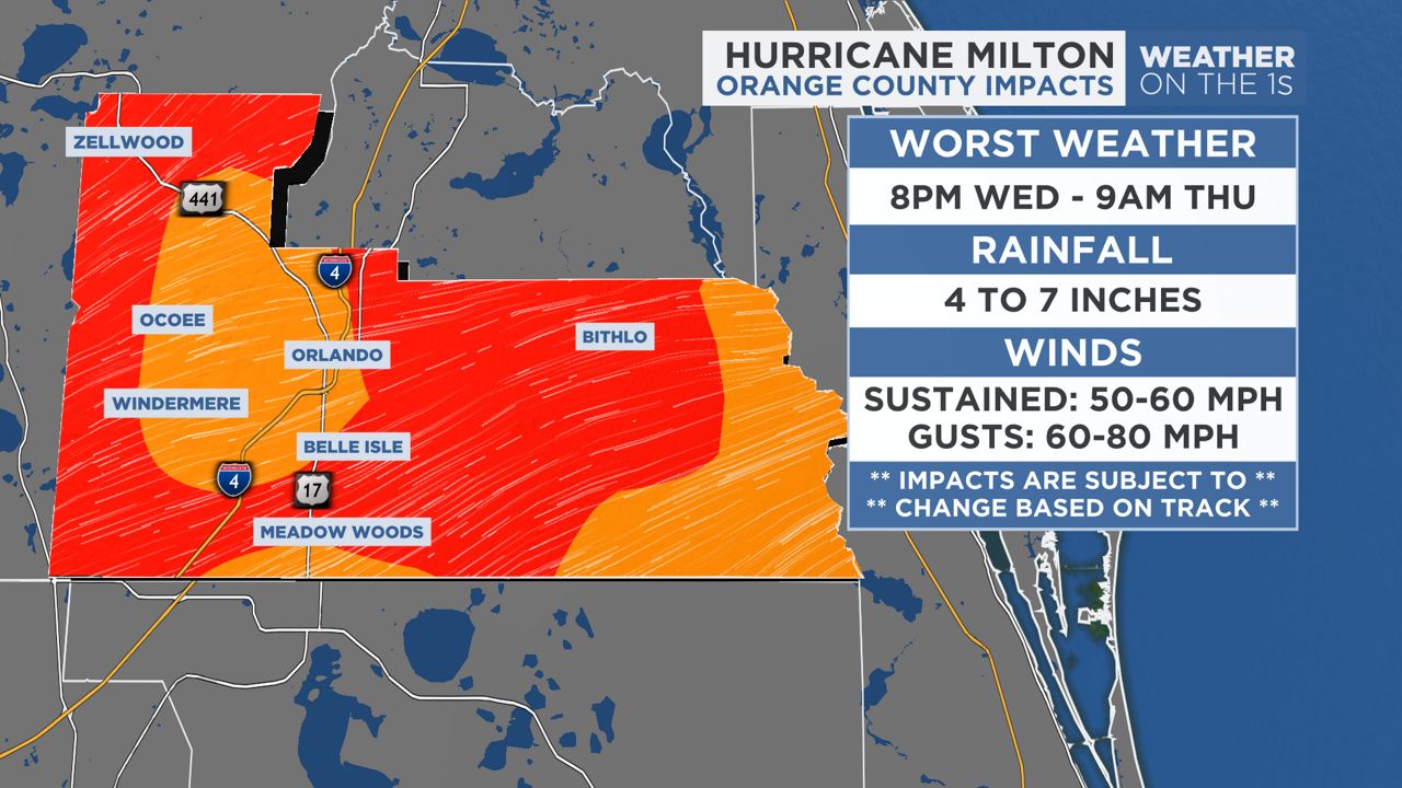
Worst Weather: 8 p.m. Wednesday — 9 a.m. Thursday
Winds: 50-60 mph, gusts to 60-80 mph
Rainfall: 4-7 inches
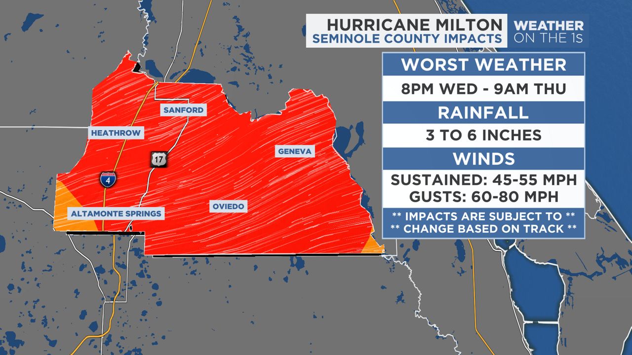
Worst Weather: 8 p.m. Wednesday — 9 a.m. Thursday
Winds: 45-55 mph, gusts to 60-80 mph
Rainfall: 3-6 inches
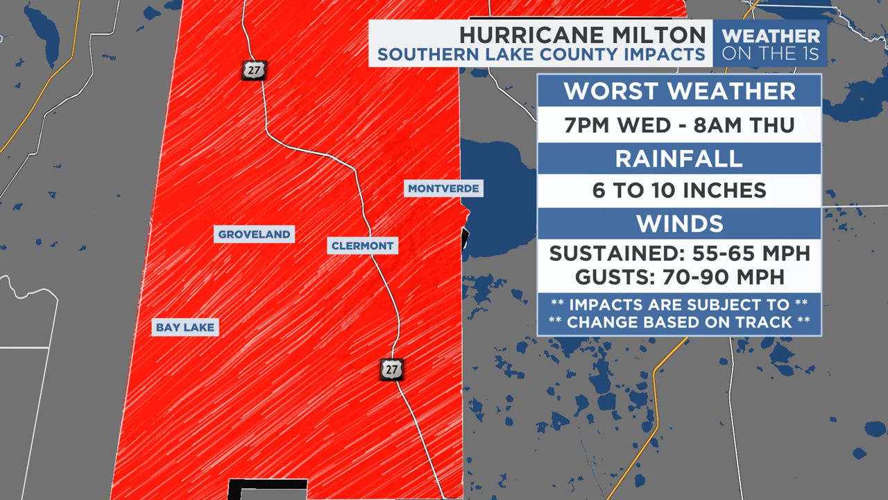
Worst Weather: 7 p.m. Wednesday — 8 a.m. Thursday
Winds: 55-65 mph, gusts to 70-90 mph
Rainfall: 6-10 inches
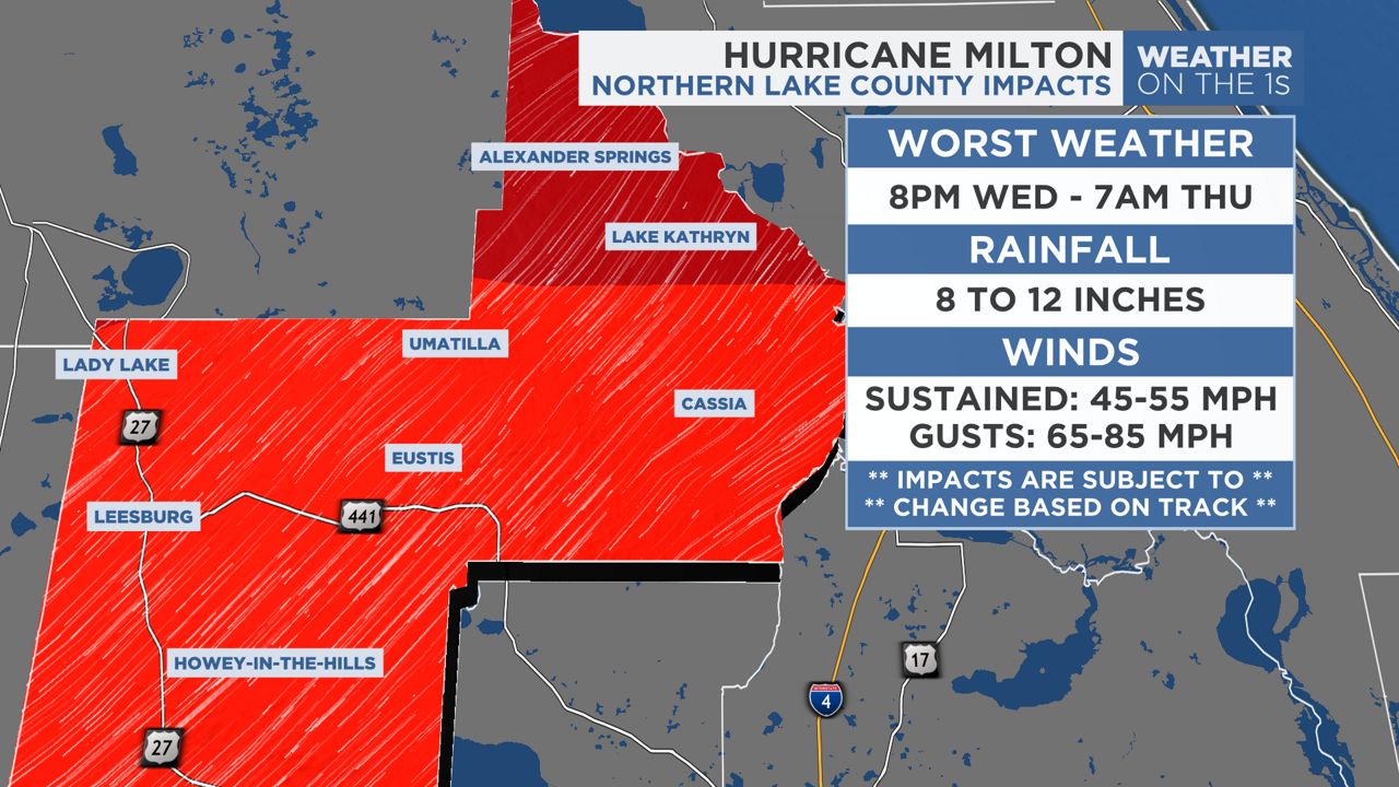
Worst Weather: 8 p.m. Wednesday — 7 a.m. Thursday
Winds: 45-55 mph, gusts to 65-85 mph
Rainfall: 8-12 inches
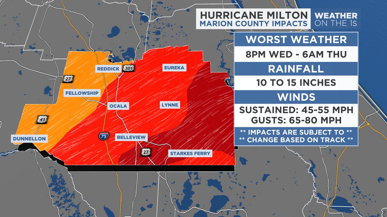
Worst Weather 8 p.m. Wednesday — 6 a.m. Thursday
Winds: 45-55 mph, gusts to 65-80 mph
Rainfall: 10-15 inches
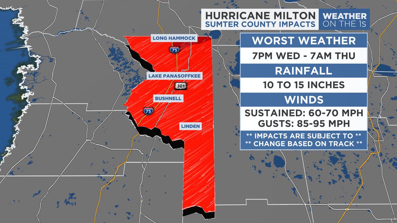
Worst Weather: 7 p.m. Wednesday — 7 a.m. Thursday
Winds: 60-70 mph, gusts to 85-95 mph
Rainfall: 10-15 inches
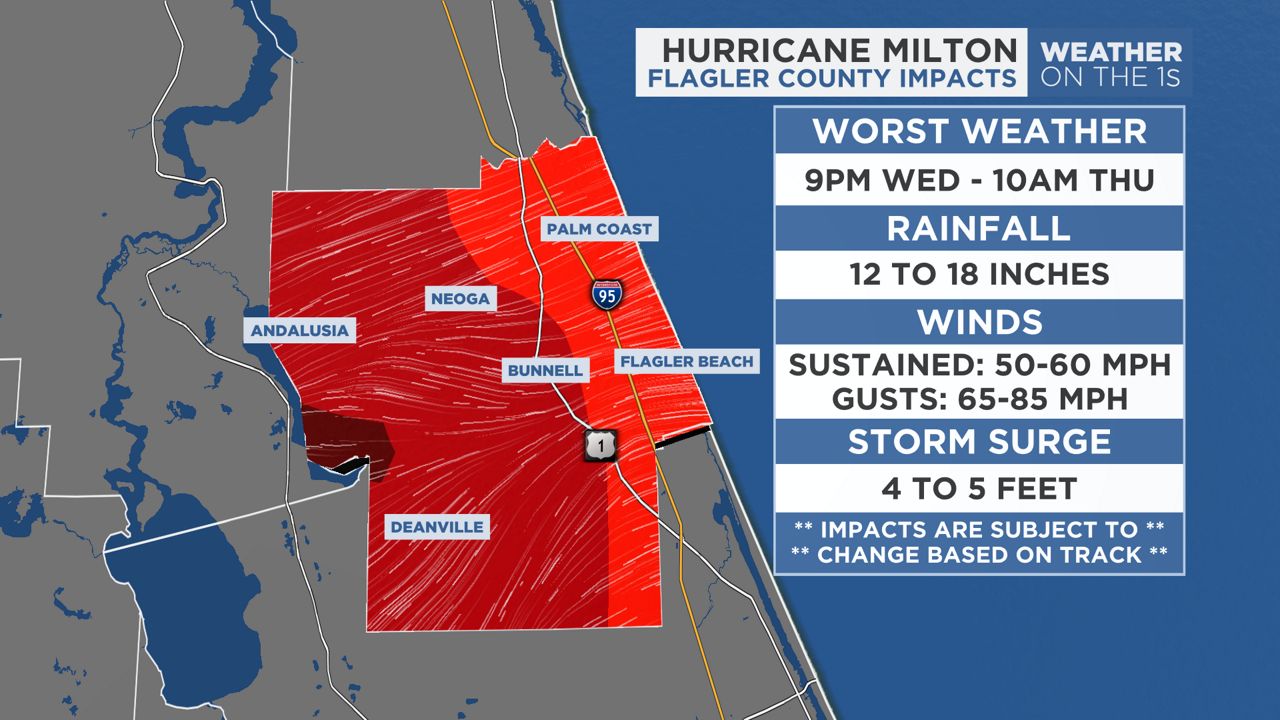
Worst Weather: 9 p.m. Wednesday — 10 a.m. Thursday
Winds: 50-60 mph, gusts to 65-85 mph
Rainfall: 12-18 inches
Storm surge: 4-5 feet in some spots
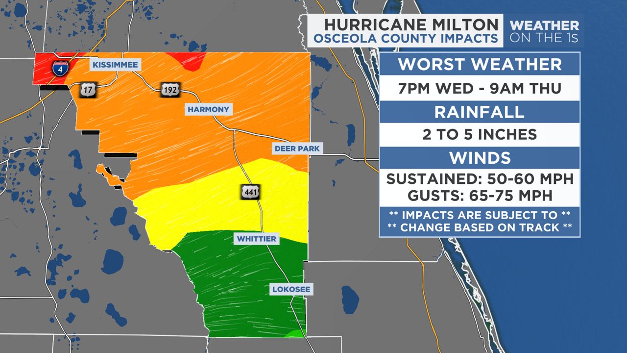
Worst Weather: 7 p.m. Wednesday — 9 a.m. Thursday
Winds: 50-60 mph, gusts to 65-75 mph
Rainfall: 2-5 inches
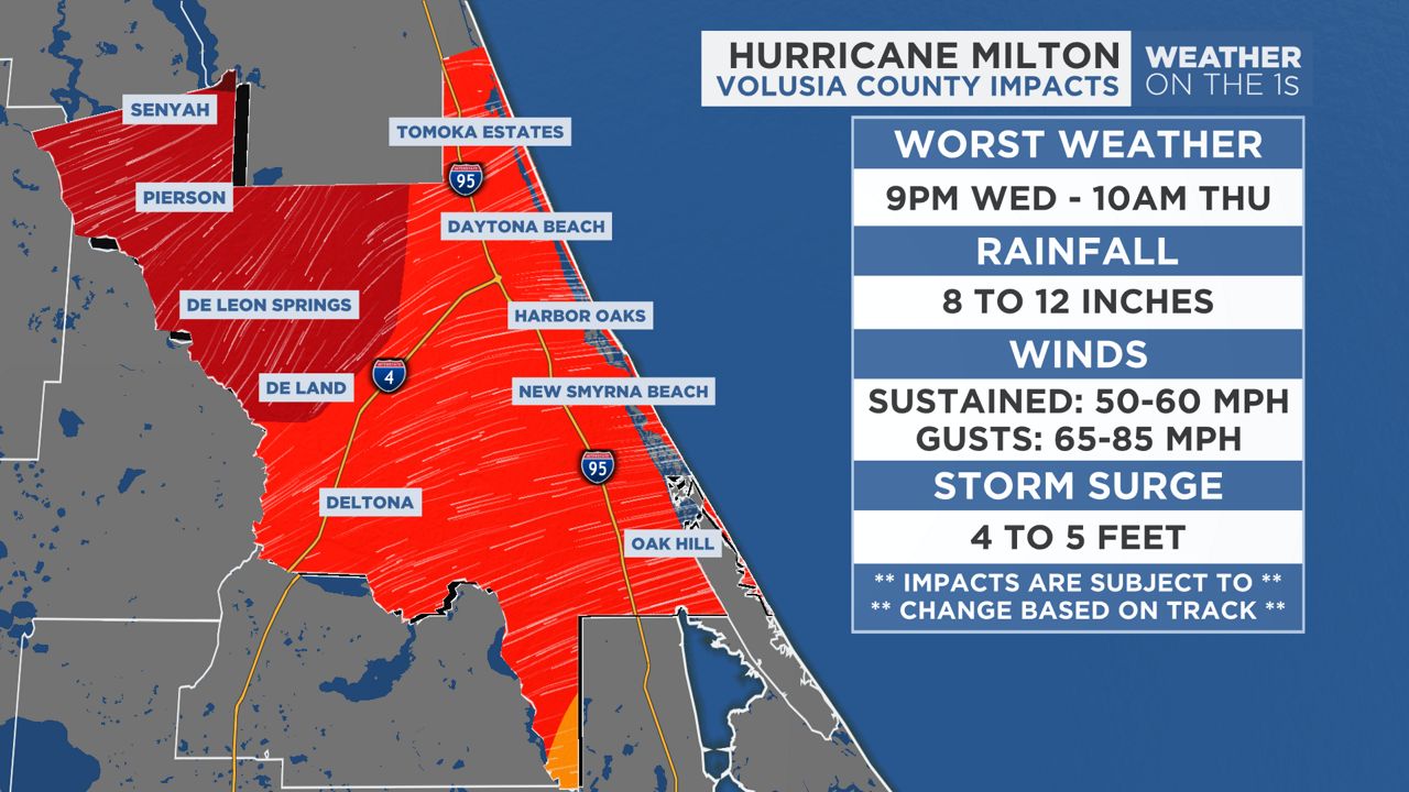
Worst Weather: 9 p.m. Wednesday — 10 a.m. Thursday
Winds: 50-60 mph, gusts to 65-85 mph
Rainfall: 8-12 inches
Storm surge: 4-5 feet
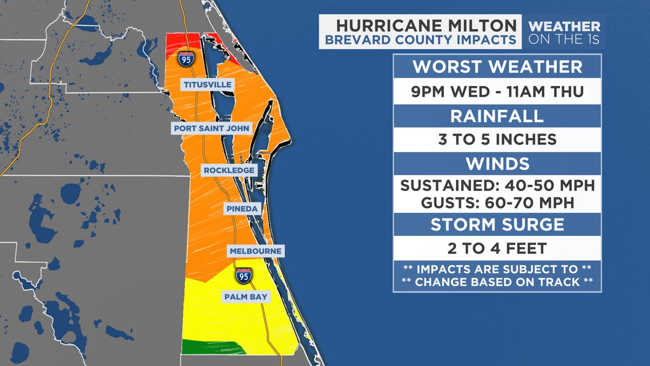
Worst Weather: 9 p.m. Wedesday — 11 a.m. Thursday
Winds: 40-50 mph, gusts to 60-70 mph
Rainfall: 3-5 inches
Storm surge: 2-4 feet in some spots
Our team of meteorologists dives deep into the science of weather and breaks down timely weather data and information. To view more weather and climate stories, check out our weather blogs section.