

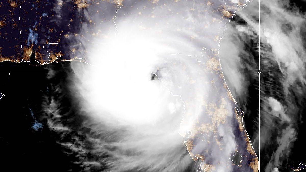
Hurricane Helene made landfall late Thursday as a Category 4 hurricane about 10 miles west-southwest of Perry in Taylor County.
The storm is currently sustaining winds of 140 mph and is moving north-northeast at 24 mph.
Rainfall in the Central Florida area should begin to quickly diminish as the drier southern side of Helene passes after midnight. A few residual showers are possible Friday morning, with a bit of sunshine by Friday afternoon.
It will remain breezy as Helene pulls away from the region. Winds will be out of the south-southwest at around 15 to 20 mph.

Tropical Storm Warnings have been issued for Brevard, Orange, Seminole, Osceola, Volusia, Flagler, Sumter and Lake counties.
All Central Florida counties are under a Tornado Watch until 6 a.m.
A Tropical Storm Warning is also issued for central/eastern Marion counties, with western Marion under a Hurricane Warning.

Rapid intensification is forecast on Thursday as the storm moves over very warm Gulf waters.
In addition to tropical alerts, flood watches have been issued for Sumter and Marion counties due to the potential of heavy rainfall that could lead to localized flooding.
)
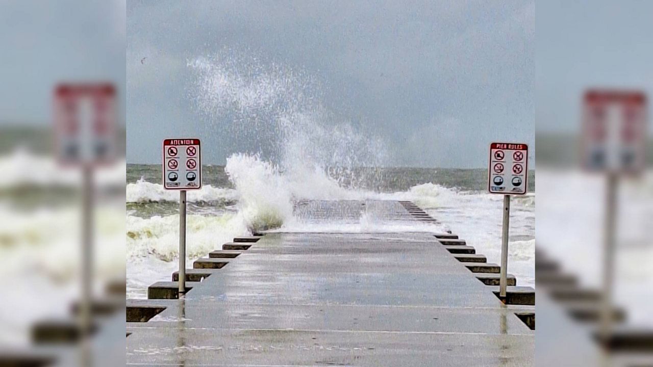
Rainfall rates of several inches an hour, upon approach of the system Thursday night, could lead to low-lying locations being the most susceptible to flooding. The biggest flood threat will be during Thursday evening into the overnight hours through very early Friday morning. Most locations will pick up between 2 to 4 inches of rainfall, but a few isolated totals of 5 to 6 inches could be possible.
The strongest winds look to remain well offshore of Florida's west coast, limiting the wind potential for Central Florida. However, Helene is expected to have a rather large wind radius compared to other Gulf of Mexico storms. This means tropical storm force winds in excess of 40 mph could be likely for much of Central Florida, especially along the I-4 corridor from Orange County west to Tampa.
)
Isolated tornadoes are possible with the outer bands on Thursday with the threat continuing Thursday night into Friday morning as the storm passes by to our west. Have a way to get alerts for tornadoes, like the Spectrum News app. It's free and available in your app store.
The worst of these bands will come Thursday evening through the overnight period into the early morning hours of Friday. Conditions will begin to improve beyond 9 a.m. Friday, but some wrap around moisture will keep at least a shot of some showers going Friday afternoon.
Winds will remain breezy on Friday as the storm passes north, but winds should decrease by the weekend.
Our team of meteorologists dives deep into the science of weather and breaks down timely weather data and information. To view more weather and climate stories, check out our weather blogs section.