OCALA, Fla. — Strong storms whipped up a brief tornado in Ocala on Sunday evening, knocking down power lines and damaging a commercial building but causing no injuries.
What You Need To Know
- Brief tornado Sunday in Ocala damages a building but causes no injuries
- Winds peak at 110 miles per hour in twister that traveled about 2 miles
- Spectrum News 13 chief meteorologist Bryan Karrick points to SLIM conditions
Winds peaked at 110 miles per hour, which means the tornado fell just short of a 2 rating on the Enhanced Fujita Scale.
“It was brief, but it was strong,” said Bryan Karrick, chief meteorologist at Spectrum News 13.
The tornado touched down near I-75 and S.R. 40 at 7:21 p.m. Sunday, then traveled east before dying about four minutes later west of Ocala’s historic downtown. Its path measured a quarter-mile in width and 2.3 miles in length, according to data from Spectrum News’ Klystron-13.
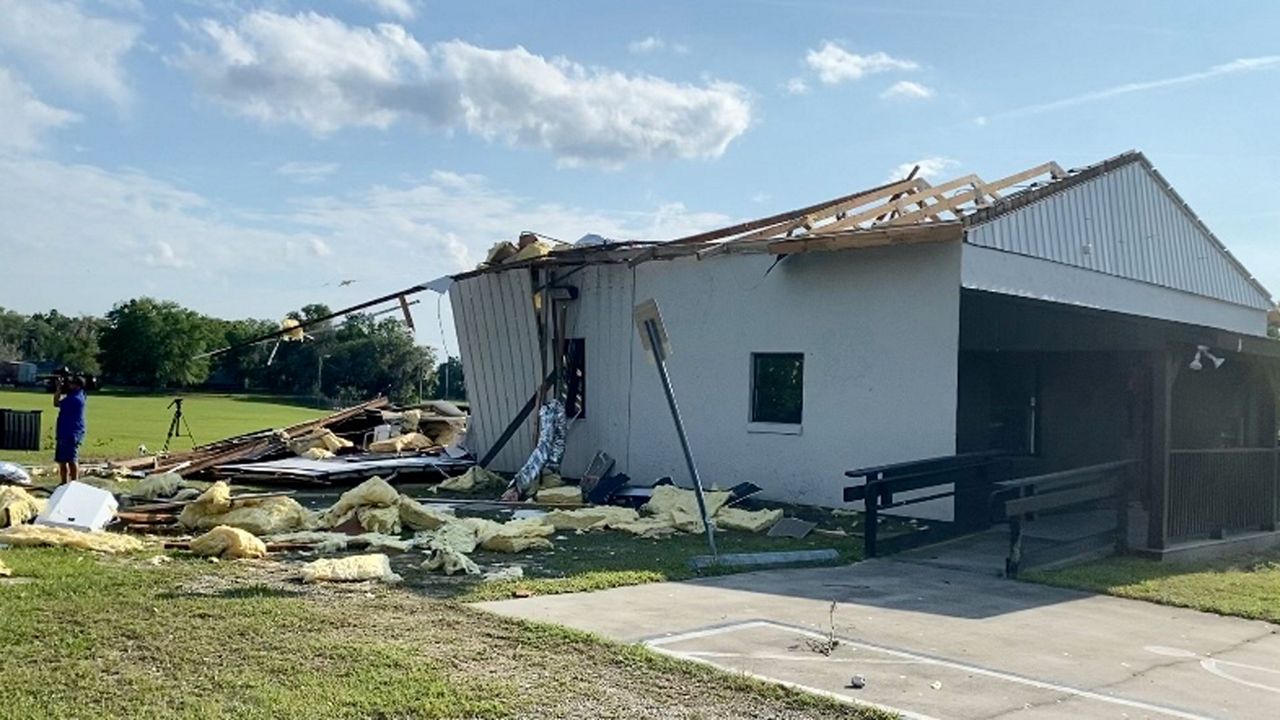
This vacant commercial building on SR 40 bore the brunt of a brief but strong tornado that hit Ocala on Sunday evening. The storm also knocked down trees and power lines but injured nobody, officials said. pic.twitter.com/DafCwex64z
— Pete Reinwald, News 13 (@petereinwald) April 19, 2021
Sgt. Paul Bloom of the Marion County Sheriff’s Office said the tornado affected less than a city block on West Silver Springs Boulevard (S.R. 40). In addition to the downed powerlines and damaged building, the twister knocked down a large oak tree and ripped street signs out of the ground, leaving them twisted, the National Weather Service reported.
It came less than a year after severe weather sparked a tornado that damaged homes in Orlando.
“It is not something that we typically see here,” Bloom wrote to Spectrum News 13 in an email about Sunday night’s tornado. “We are more accustomed to dealing with hurricanes.”
Although conditions suggested only a marginal risk for severe weather, Spectrum News 13’s Karrick emphasized that any thunderstorm can spark a tornado if the conditions create what meteorologists call SLIM:
- Sheer (change in wind speed or direction)
- Lift (a front or area of low pressure)
- Instability (temperature changes in the atmosphere)
- And Moisture (high dew points)
A nearby front provided extra lift for Sunday’s tornado, Karrick said.
“Any thunderstorm that develops with the given conditions can briefly spin up tornadoes,” he said.
Because of a stalled front, Central Florida continues to see chances for thunderstorms and locally heavy rain through Tuesday, with rain chances dropping from 80% on Tuesday to 20% on Wednesday.


