

ORLANDO, Fla. — Severe thunderstorm warnings were issued Friday afternoon for parts of Orange and Lake counties.
- Storms possible this weekend
- Send us your weather photos and get the latest forecast via the Spectrum News 13 app
- CURRENT CONDITIONS: Temperatures, heat indexes, trends
- SEE BELOW: See our 7-day forecast ▼
- CALCULATE: How hot can your vehicle get? ▼
The warnings, which lasted until 6:45 p.m., were for the areas of west Orange and east Lake counties, after a severe thunderstorm was spotted near Winter Garden. The storm was moving southwest at 5 mph.
Forecasters said the storm could produce quarter-sized hail and 60 mph wind gusts.
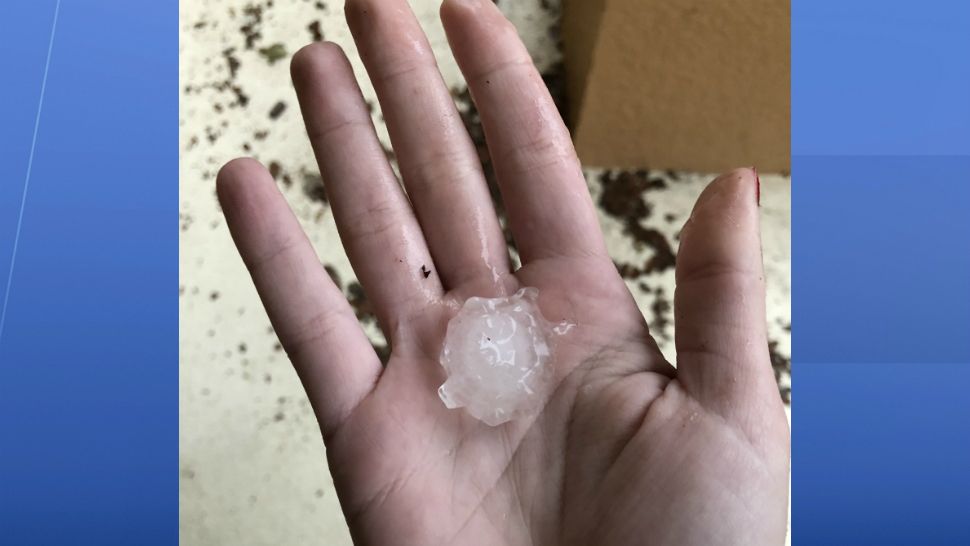
Residents in Winter Garden reported an unusually powerful hail storm pounding the west Orange County community.
Kirk Jones said saw hail as large as 2 inches in diameter.
“It’s still hailing right now,” Jones told Spectrum News 13 just after 6 p.m. “It’s huge.”
Other areas in the storm's path included Ocoee, Montverde, Windermere, Bay Lake, and Ferndale.
Mostly clear skies are in the forecast through the overnight hours. Temperatures will be warm and muggy, falling into the mid-70s.
After a quiet morning, a few showers and storms will develop Saturday afternoon as the east coast sea breeze moves inland.
- View LIVE Interactive StormTracker 13 Radar Map
- View our LIVE Sky 13 Weather Cameras
- Sign up for Severe Weather Alerts
We’ll see a mix of sun and clouds with temperatures back in the mid to low 90s. High humidity sticking around will make it feel more like 100 degrees at times. This will be the case Sunday as well as into early next work week.
Rain chances will pick up by mid-week and help to knock temperatures down a few degrees.
Beach and Surf Conditions
It is shaping up to be another good day for boating on Saturday, with afternoon storms developing inland and light southeasterly winds.
Surfers will again have poor-to-fair conditions, with a small east-northeasterly trade swell.
The rip current threat is low for Saturday, with Atlantic water temps in the upper 70s to mid 80s.
Tropical Update
Things once again are quiet in the tropics. There are no major issues in the Atlantic, the Caribbean or the open waters of the Atlantic.
No major activity is expected over the next 5 days.
Atlantic hurricane season runs through November 30.

We want your pictures!
Show us what the weather looks like in your neighborhood. Your photo could end up on Spectrum News 13.
- Get the Spectrum News 13 app for iOS or Android
- Tap "Submit Content" at the bottom of the app menu
- Remember to include your name and location