


Monday will begin with some low clouds and very patchy fog across much of the Lone Star State. They will quickly dissipate by midday, leaving mostly sunny skies.
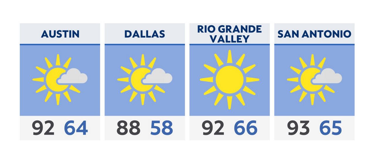
It will be a breezy and very warm afternoon for most of us, with highs in the low and middle 90s. North Texas will be the first region to see a weak cold front arriving by afternoon. Highs there will be limited to the middle 80s with increasing clouds.
The boundary continues the southward push overnight and arrives in Austin and San Antonio by Tuesday morning. As a result, Tuesday’s high temperatures will be about 8-10 degrees cooler.
A low chance of rain is forecast with the front in the vicinity, but most of us will not see measurable rain.
That front stalls near a Laredo-Corpus Christi line Tuesday evening. As it washes out, south winds and hotter temperatures return by Wednesday.
We’ll be very warm and dry through the end of the week.
Click here for the latest 7 Day Forecast | Click here to share your weather photos