

)
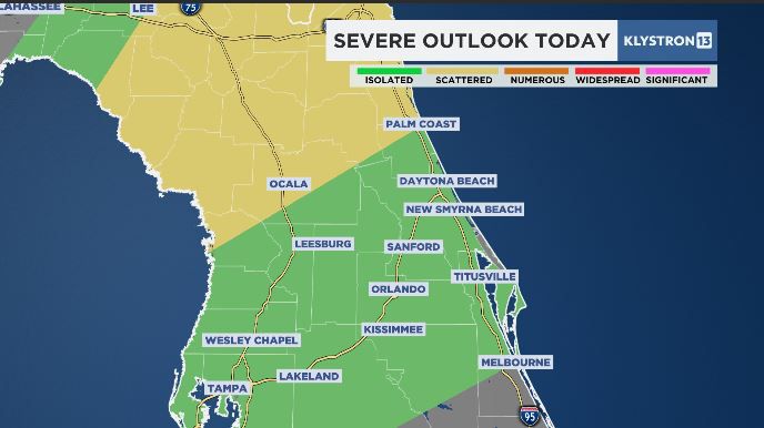
ORLANDO — A cold front that will move across Central Florida on Wednesday will be accompanied by a line of showers and storms, some of which may turn severe.
What You Need To Know
- Storms will move into Marion County after the morning commute
- The line will arrive by midday along the I-4 corridor
- The front will clear the Brevard County coast during the afternoon
This will be a fast-moving system. So, while it won't impact our weather for long, the storms that do develop may reach severe limits. In order for severe criteria to be met, winds have to be at 58 mph, hail must be 1 inch in diameter, or the storms might spin up a possible tornado.
The trailing end of the front will push a line of storms first to Marion County by around 10 a.m. ET. The storms will advance toward the I-4 corridor by lunchtime and clear the Brevard County coast by 3 p.m ET.
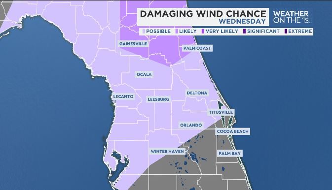
Strong winds will be the primary threat when this line moves through. In advance of the front, gusty southwest winds will be noticed throughout the morning; winds will turn west to northwesterly once the front passes.
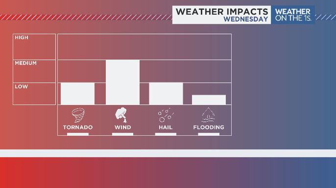
Brief heavy rain can be expected, but it should not be enough to result in widespread flood concerns. Small hail cannot be ruled out, along with an isolated tornado.
Much of the activity will occur while Central Floridians are at work and school, so it is important to know where your safe place is. Check in often with the Spectrum News app when away from your television, and have notifications turned on.
Skies will be quick to clear by Wednesday night as cooler air pours in. Highs on Thursday will only reach the upper 60s, below the typical high of 77 degrees for early March.