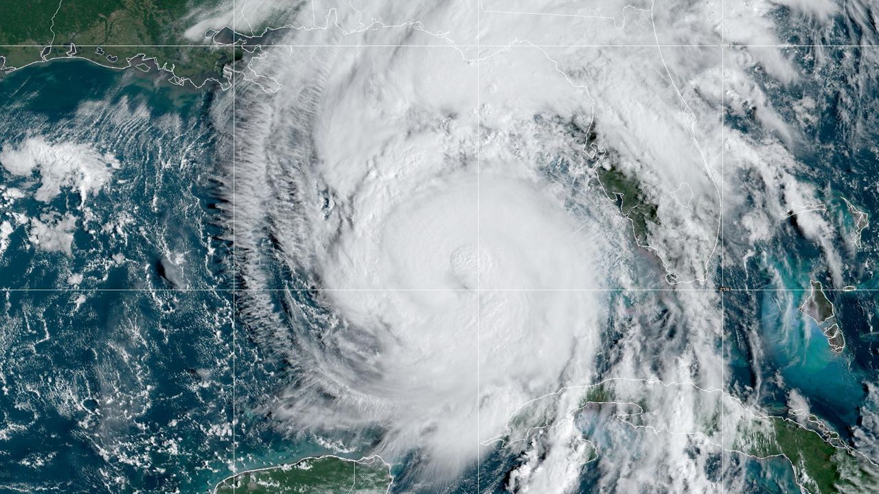
The National Weather Service in Ruskin released its report on Helene's impact to the area.
These are the county by county reports released by National Weather Service meteorologists.
Surface observations indicate peak wind gusts generally between 50 to 60 mph, with a maximum gust of 54 mph near Lecanto at 9:45 PM EST on September 26. Rainfall ranged from 1 to 3 inches, with a maximum total of 2.66 inches near Homosassa. A peak water level of 7.70 feet above MHHW (mean high tide) was measured at the mouth of Crystal River at 2:30 AM EST on September 27, surpassing the previous site record of 5.99 feet above MHHW during Hurricane Idalia on August 30, 2023. Peak water levels measured elsewhere along coastal Citrus County generally ranged from 5 to 8 feet.
Surface observations indicate peak wind gusts generally between 60 to 70 mph, with a maximum gust of 66 mph at Weeki Wachee at 7:28 PM EST on September 26. Rainfall ranged from 2 to 4 inches, with a maximum total of 3.44 inches near North Brooksville. A peak water level of 8.58 feet above MHHW was measured at the mouth of the Chassahowitzka River at 1:15 AM EST on September 27. Peak water levels estimated elsewhere along coastal Hernando County generally ranged from 5 to 8 feet.
Surface observations indicate peak wind gusts generally between 50 to 60 mph, with a maximum gust of 56 mph near New Port Richey at 7:10 PM EST on September 26. Rainfall ranged from 1 to 3 inches, with a maximum total of 2.94 inches near Holiday. A peak water level of 5.04 feet above MHHW was measured at New Port Richey at 9:00 PM EST on September 26, before the gauge stopped reporting. Peak water levels estimated elsewhere along coastal Pasco County generally ranged from 2 to 5 feet above MHHW.
Surface observations indicate peak wind gusts generally between 65 to 75 mph, with a maximum gust of 73 mph at Clearwater Beach at 7:36 PM EST on September 26. Rainfall ranged from 3 to 5 inches, with a maximum total of 4.38 inches observed near Crystal Beach. A peak water level of 6.67 feet above MHHW was measured at Clearwater Beach at 10:00 PM EST on September 26, surpassing the previous site record of 4.02 feet above MHHW set during the 1993 Storm of the Century on March 13, 1993. St. Petersburg also set a new record of 6.31 feet above MHHW, surpassing the previous site record of 3.97.
Surface observations indicate peak wind gusts generally between 60 to 70 mph, with a maximum gust of 68 mph near Tampa International Airport at 7:40 PM EST on September 26. Rainfall ranged from 2 to 5 inches, with a maximum total of 4.55 inches near Temple Terrace. A peak water level of 7.2 feet above MHHW was measured at East Bay at 11:48 PM EST on September 26, surpassing the previous site record of 4.56 feet above MHHW set during Hurricane Idalia on August 30, 2023. Old Port Tampa also set a new record at 6.86 feet above MHHW at 11:36 PM EST on September 26, surpassing the previous site record of 4.18 feet above MHHW set during Hurricane Idalia on August 30, 2023. Peak water levels measured elsewhere along coastal Hillsborough County generally ranged from 5 to 8 feet above MHHW.
Surface observations indicate peak wind gusts generally between 65 to 75 mph, with a maximum gust of 74 mph at Sarasota-Bradenton International Airport at 6:19 PM EST on September 26. Rainfall ranged from 2 to 4 inches, with a maximum total of 3.26 inches near Desoto Lakes. A peak water level of 6.04 feet above MHHW was measured at Port Manatee at 11:18 PM EST on September 26, surpassing the previous site record of 3.69 feet above MHHW set during Hurricane Idalia on August 30, 2023. Peak water levels estimated elsewhere along coastal Manatee County generally ranged from 4 to 7 feet above MHHW.
Surface observations indicate peak wind gusts generally between 50 to 60 mph, with a maximum gust of 59 mph near Fort Meade at 5:56 PM EST on September 26. Rainfall ranged from 1 to 2 inches, with a maximum total of 1.88 inches near Lakeland.
Our team of meteorologists dives deep into the science of weather and breaks down timely weather data and information. To view more weather and climate stories, check out our weather blogs section.


