


Lake effect snow is something we hear about almost every day in the winter months. The reason is because of the Great Lakes. All five lakes —Superior, Huron, Michigan, Erie and Ontario — produce lake effect snow throughout the winter.
It works like this: cold air has to pass over the open waters of the Great Lakes. As the colder air moves over the warmer water, moisture gets sent up into the atmosphere. From there the water cycle takes over. Clouds form, and eventually produce snowfall. Lake effect snow usually forms in narrow bands. That means that some people can be experiencing sunshine while others are getting buried in snow!

Wind direction controlls where the band of snow will move. In Buffalo, a southwest wind is the most favorable in providing our region with snow.
Sometimes, although not as common, Lake Ontario will provide portions of WNY with snow. For this to happen, the wind direction would have to come out of the northeast or northwest. One shift in wind direction can change the area forecasted to get snow and move it either north or south, creating one of the biggest forecasting challenges.
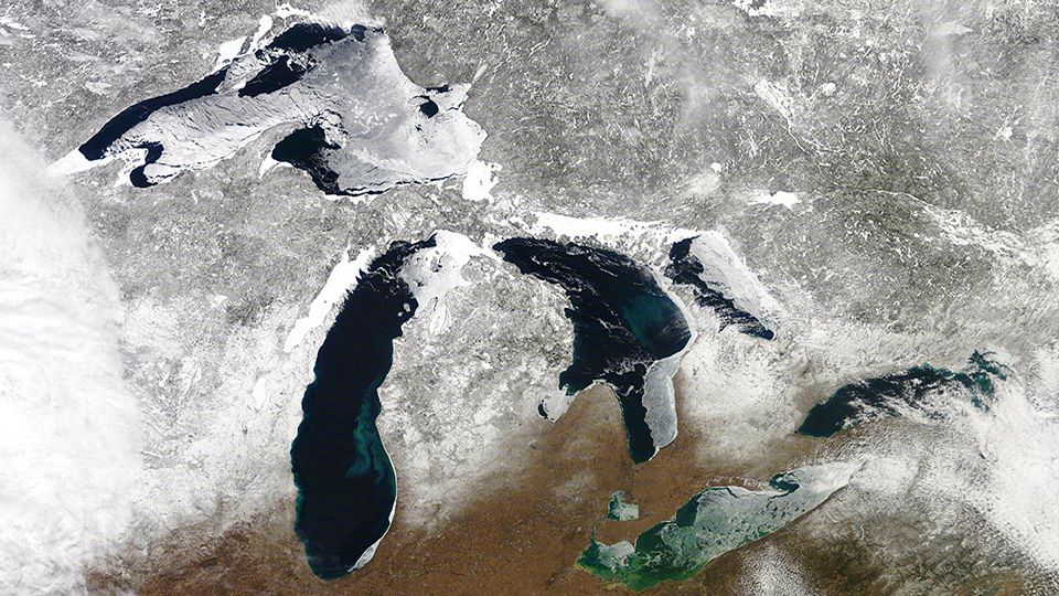
On top of wind direction, geography plays a role in lake snow. For starters, the shape and depth of the lake is crucial. Lake Erie is shallow (201 feet) and is oriented in a southwest fashion. That is one of the reasons why if we get a southwestern breeze, optimum lake snow can be expected.
Because of how shallow it is, Lake Erie is usually one of the first lakes to freeze over. That shuts down the lake effect snow season for WNY sooner than the other Great Lakes. Lake Ontario comparatively is 802 feet deep! That means the lake will never freeze entirely over keeping the lake effect season open longer.
Geography on land also can control where lake effect snow lands. One example of this is the Chautauqua Ridge. This area, south of Buffalo, sees some of the most snow off of the lakes every single year! For example, in the 2018-2019 Winter season, the Buffalo airport picked up 118.8” of snow while areas in the higher elevations saw closer to 230”.

Each year, lake effect snow amounts will vary. Hopefully now, you will be able to look for clues to help you figure out when the next big event is coming our way!