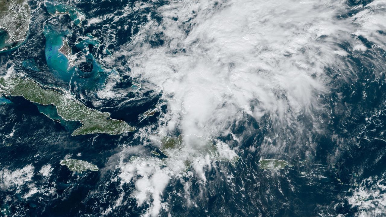


Helene formed in the northwestern Caribbean Sea last Tuesday and became the eighth named storm of the 2024 Atlantic hurricane season. It was the fifth hurricane, the second major one (Category 3+) of the season.
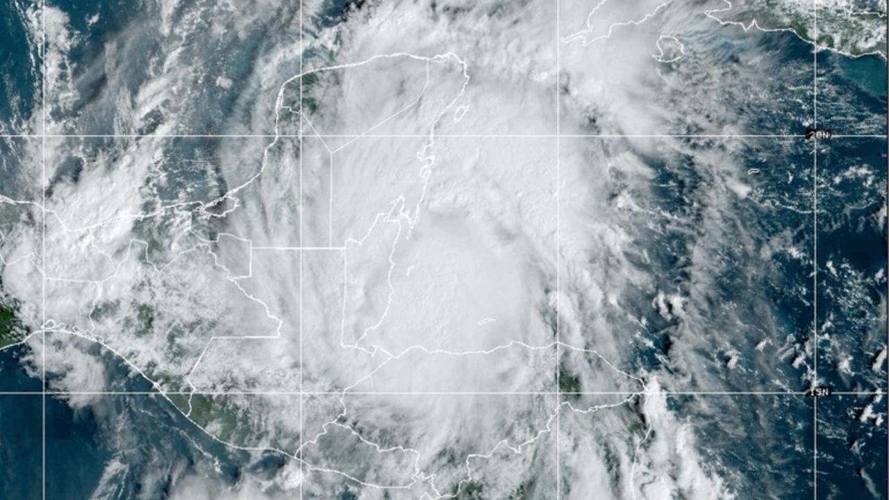
Helene developed from a tropical disturbance in the Caribbean Sea, becoming a tropical storm as it approached the Yucatan Peninsula last Tuesday. Because of the warm waters of the Gulf of Mexico and its slow progression to the north, Helene became a hurricane early on Wednesday.
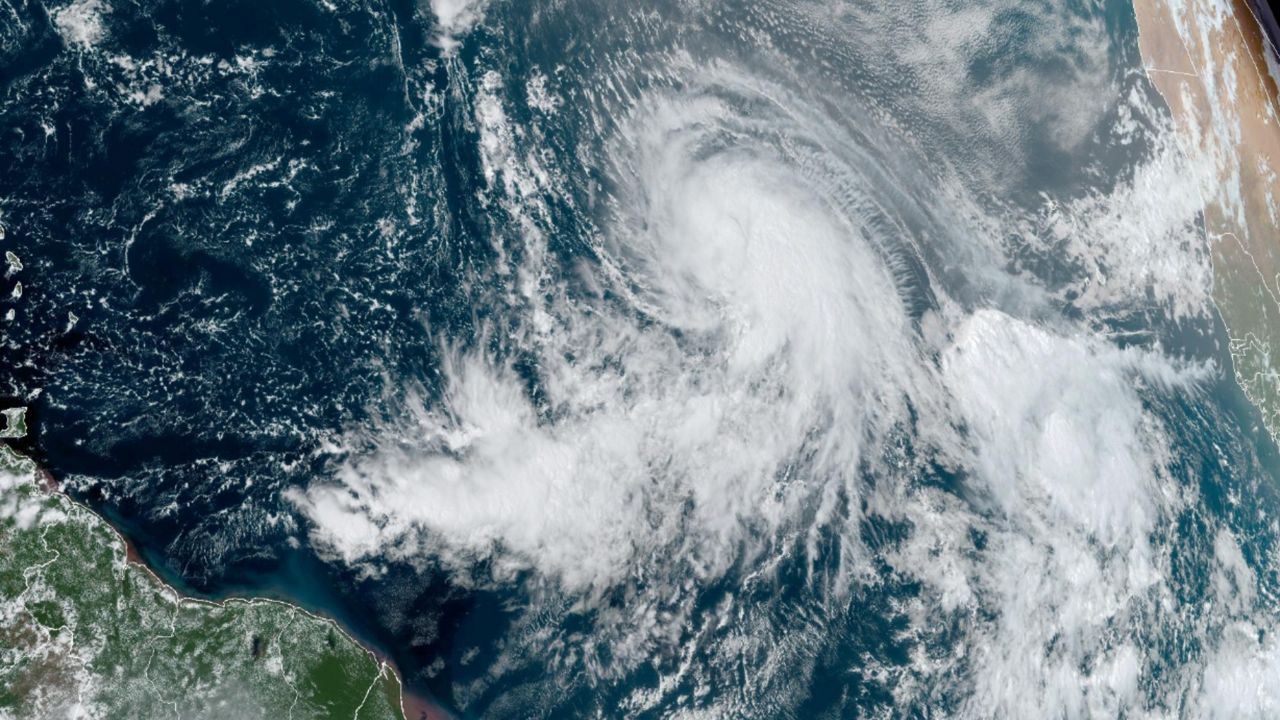
As it approached the southeastern Gulf of Mexico and the loop current, Helene rapidly intensified into a Category 4 hurricane.
On Thursday evening, Helene reached peak intensity with winds of 140 mph before it made landfall near Perry, Fla., along the Big Bend region, maintaining winds of 140 mph and peak intensity.
As Helene moved inland, it quickly weakened to a tropical storm and eventually became a post-tropical cyclone on Friday over Tennessee before stalling out and finally dissipating on Sunday.
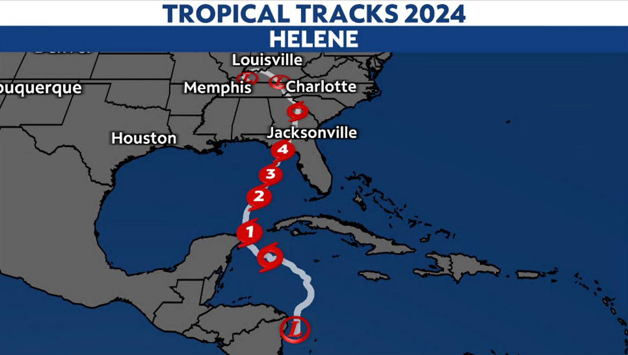
Helene was, at times, a large storm, with hurricane-force winds extending outwards of 60 miles from the center at one point. The tropical storm-force winds extended over 300 miles from the center.
Impacts along the Southeast
An upper-level disturbance merged with the weakening Helene as it traversed Georgia and South Carolina. This helped enhance the high moisture of Helene, bringing catastrophic rainfall and flooding to areas in the southeast, thanks to orographic lift.
Atlanta, Georgia, had its first ever Flash Flood Emergency on Friday morning when 11.12 inches of rain fell over 48 hours, the most the city has seen over two days since record keeping began in 1878.
Flooding from Peachtree Creek in the Atlanta area. Flash Flood Emergency in effect. #GAWX pic.twitter.com/nVgXVfo6lx
— Steve Smith (@stevesmith1043) September 27, 2024
Other areas inundated with water include the mountains in western North Carolina and South Carolina. This happened because the air from Helene was forced up the Blue Ridge and Appalachian Mountains, causing it to cool and condense into clouds, making it rain out along the higher terrain.
Locations along the Blue Ridge Mountains saw rainfall by the feet, resulting in catastrophic flash flooding. This is not the first big flood event to impact western North Carolina. Two of the most notable flood events to affect this area happened in 1916 and 1940.
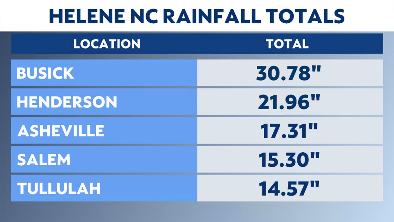
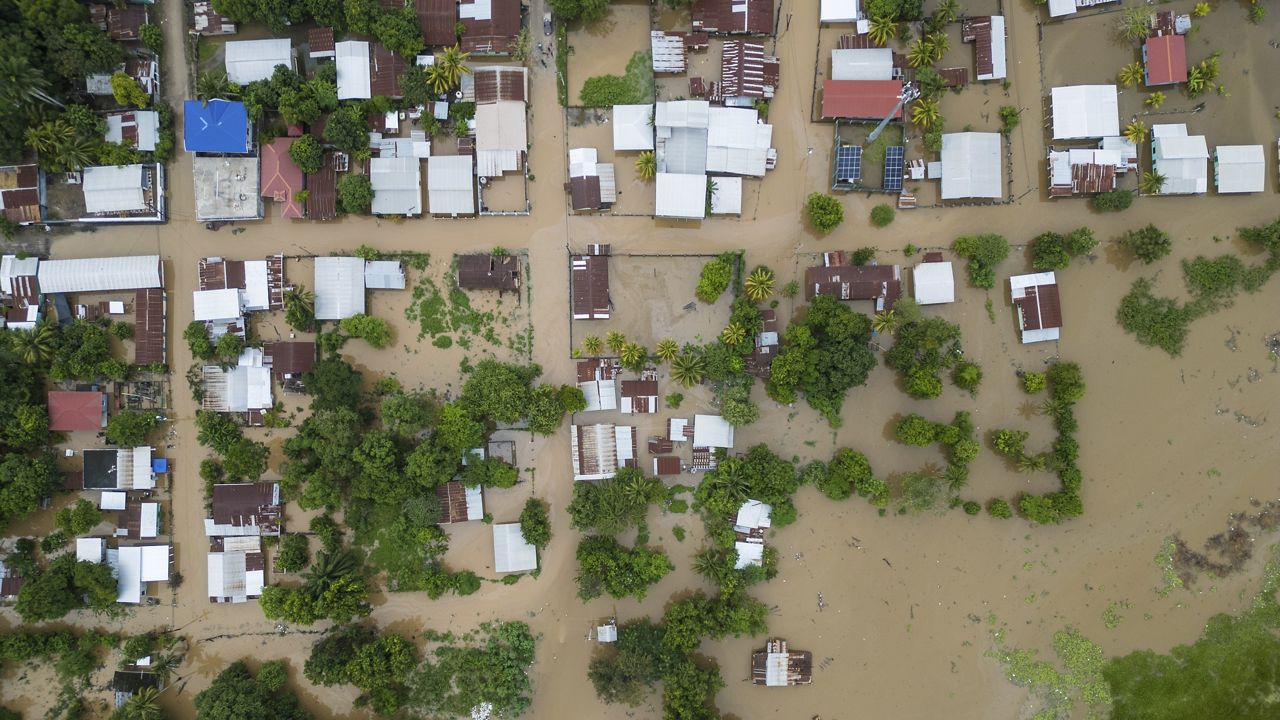
Asheville, N.C., was one area devastated by the heavy rain and flooding. The Biltmore Village is almost unrecognizable after the water receded.
The water receded at Biltmore Village today revealing the devastation. I have been in this area many times, and today it was not recognizable. Now that the water is gone the rebuilding process can begin #helene #ncwx #asheville pic.twitter.com/ZgMYFrZJ07
— Dan Whittaker (@severeforecast) September 30, 2024
Jeremy Wallace, near the town of Edgemont, N.C., shows what Helene did to the normally calm stream behind his house.
Photos of the impacts of Hurricane Helene from Florida to South Carolina to North Carolina.
Our team of meteorologists dives deep into the science of weather and breaks down timely weather data and information. To view more weather and climate stories, check out our weather blogs section.
)