The 2024 Atlantic hurricane season began on Saturday, June 1, and NOAA just updated its annual outlook. NOAA's mid-season forecast isn't too different from the early season. Above-normal activity across the Atlantic basin this year is still forecasted.
NOAA's outlook predicts an 85% chance of an above normal season, a 10% chance of a near normal season and a 5% chance of a below normal season.
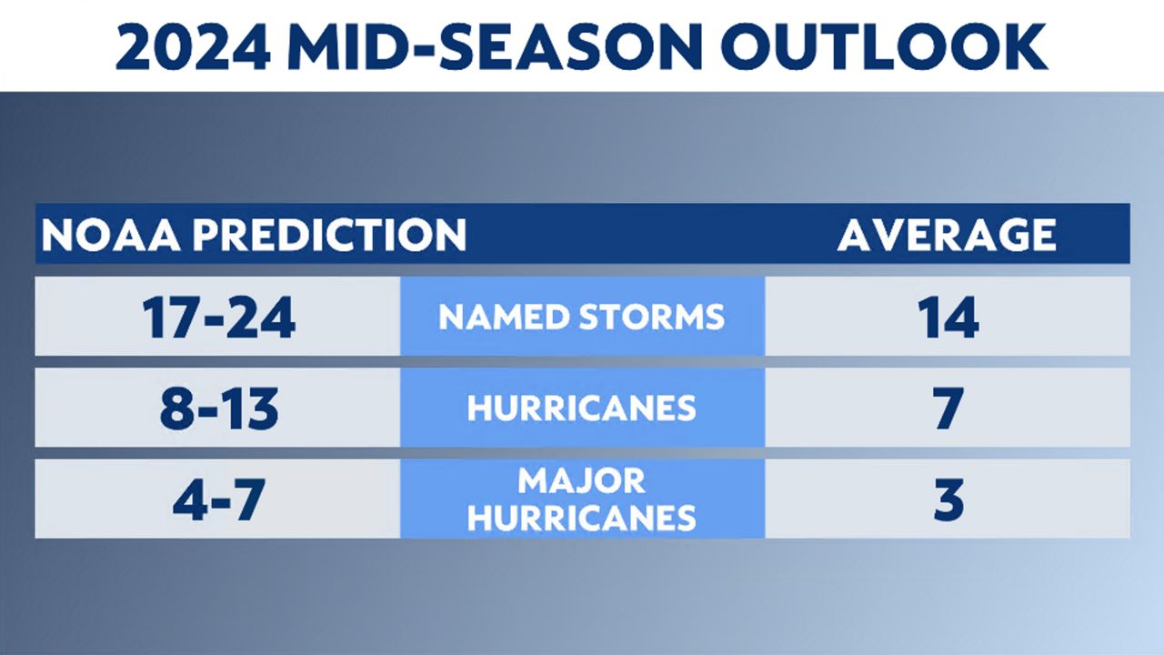
NOAA forecasts a likely range of 17 to 24 named storms, which is down one total named storm from their earlier prediction, of which 8 to 13 could become hurricanes, including 4 to 7 major hurricanes, which are a Category 3 or higher on the Saffir-Simpson Hurricane Wind Scale. This updated forecast includes the four named storms so far this season.
NOAA provides these ranges with a 70% confidence.
"This is the highest number of named storms NOAA has ever issued in its May forecast," says Dr. Rick Spinrad, Ph.D., administrator, NOAA.

Remember, predictions of the season’s activity are not predictions of exactly how many storms will make landfall in a particular place. Individual storms make impacts, regardless of how active (or not) a season is. Coastal residents should do what they can to make sure they're prepared every year.
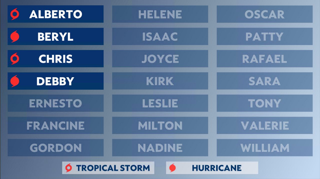
As a reminder, this season has brought some new changes and a new list of names.
We've already see two tropical storms and two hurricanes. The next name on the list is Ernesto.

You can learn more about 2024's list of names here.
Researchers look at a variety of factors to make their prediction.
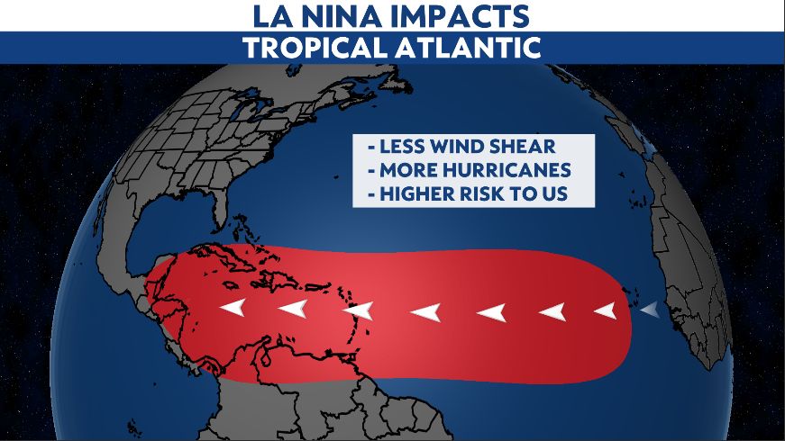
Current El Niño conditions are forecast to transition to La Niña conditions later this summer or fall, leading to more favorable conditions for tropical development.
La Niña conditions typically favor more hurricane activity in the Atlantic because of weaker vertical wind shear and more instability across the main development region.

Sea surface temperatures are also running well above normal in the Gulf of Mexico and the tropical Atlantic, including the main development region. Some areas are experiencing record warmth.
Warm ocean water helps fuel tropical systems, and combined with the effects of La Niña, it is expected to be an active Atlantic hurricane season.
Here is the latest tropical update for the next 48 hours.
Learn More About Hurricanes
Our team of meteorologists dives deep into the science of weather and breaks down timely weather data and information. To view more weather and climate stories, check out our weather blogs section.


