The clock is ticking and with every passing day, the 2023 Atlantic hurricane season nears ever closer. Now, as we sit just under 70 days away from the official start, here’s everything you need to know about the changes to this upcoming season.
After every hurricane season ends, the National Hurricane Center and the World Meteorological Organization take a step back and review the past season.
This includes an in-depth look at what worked, what didn’t and what needs to change in order to assure we’re communicating the message of tropical forecasts in an accurate and straightforward way.
Before any changes are ever rolled out to the public, they are tested internally between the National Weather Service, the National Hurricane Center and various partners, including communications specialists and media professionals.
In previous years, some changes that have been implemented are the naming of subtropical storms, the extension of Tropical Weather Outlooks to five days and implementing Storm Surge Watches and Warnings.
Now as we near the start of another season, here are the fresh changes you’re going to see this year.
The first notable change you’re going to find this year will take place on, or around, May 15 as the National Hurricane Center introduces a new Tropical Weather Outlook format.
Tropical Weather Outlooks are extremely useful forecasts for the public and meteorologists alike. These outlooks provide an insight on where the National Hurricane Center is focusing on for potential tropical development.

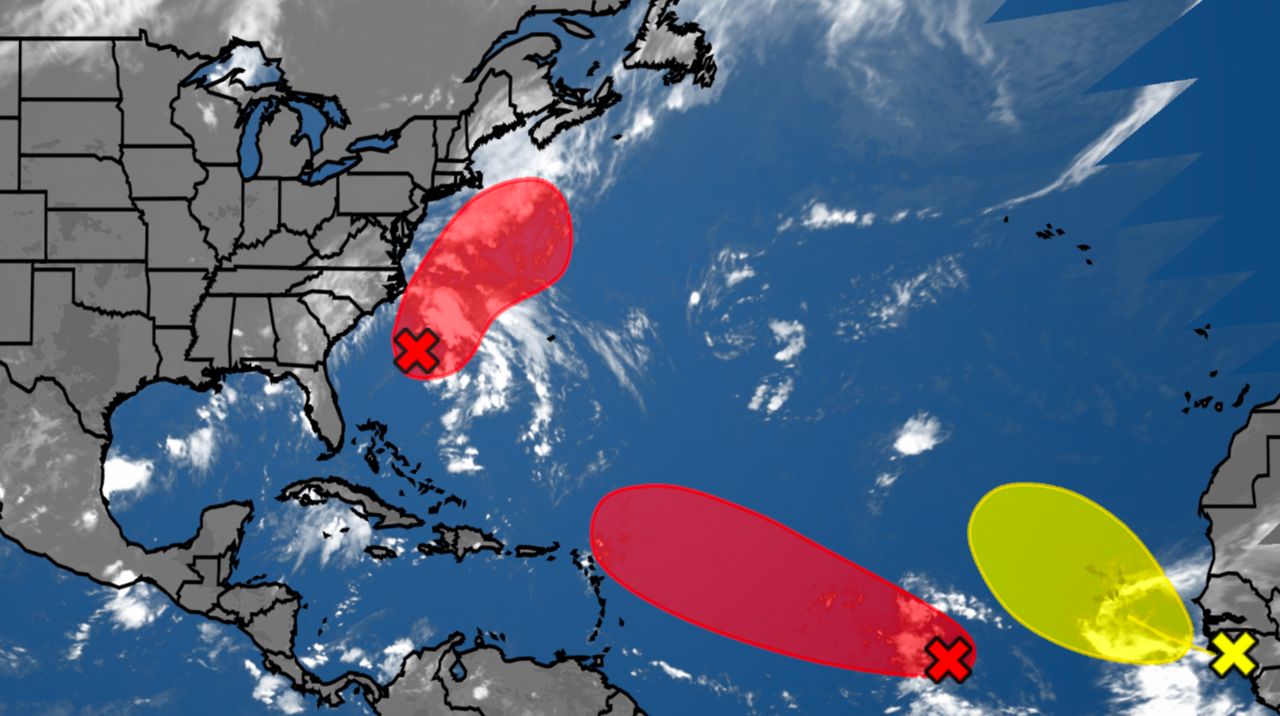
Right now, these outlooks — known as TWOs — go out five days into the future. The graphical outlook highlights areas in either yellow, orange or red, depending on the percentage odds that area has to develop into a tropical system.
The text outlook provides a textual context, including if the area outlined is increasing or decreasing its odds of development.
Now, the National Hurricane Center will be extending the TWOs again, this time out to seven days. This means we'll now begin getting regularly issued forecasts on May 15 that extend out a week in time, highlighting areas in the Atlantic, Gulf of Mexico and Caribbean Sea that may produce a storm within the next seven days.
These forecasts will continue to be produced four times a day: 2 a.m., 8 a.m., 2 p.m. and 8 p.m. ET through Nov. 30.
At the end of each hurricane season, the World Meteorological Organization—a part of the United Nations—reviews the historical context of the season.
What storms were the most deadly? Which produced the costliest damage? This evaluation helps determine what names will be retired, and what names will join the list in their place.
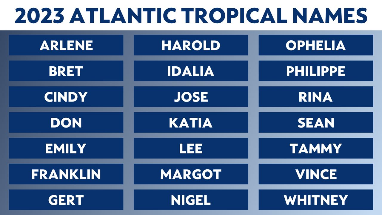
This year, we're set to use a list that was last used in 2017. That year saw several major systems cross the Atlantic basin, including three major systems to affect the United States: Harvey, Irma and Maria.
This year, four new names will be replacing the names the WMO retired. The new names are Harold, Idalia, Margot and Nigel.

It's not uncommon to see the "I" name retired. According to past hurricane season data, the WMO has replaced the "I" name storm the most out of any letter. Since 1954, that storm letter has been retired 12 times.
Back in early 2021, it was reported that an agenda item on an upcoming WMO meeting would include a discussion about proposed changes to the start date of the Atlantic hurricane season.
Right now, the Atlantic hurricane season runs from June 1 to Nov. 30.
That proposal required NOAA and RSMC Miami to create a team to examine the need, if any, there was to adjust the start or end dates of hurricane season, and the ramifications it could have if we did so.
HURRICANE 101: FREQUENTLY ASKED QUESTIONS
And now, Spectrum News can confirm that the team has concluded that the start dates will not be changed for any upcoming hurricane season.
A spokesperson for the National Hurricane Center, in a statement to Spectrum News, confirms that the findings by the team assembled in 2021 suggest that changing the start date of the hurricane season would provide no substantial change to a hurricane season. Specifically, the team looked at moving the start date up by two weeks.
The team concluded that by doing so, only an additional 1% of tropical cyclone activity would occur during that two-week span. Currently, 96% of all tropical cyclone activity occurs during the current timeframe of the Atlantic hurricane season. That additional 1% was deemed too low to be considered worth moving the season's start date. Therefore, the Atlantic hurricane season will continue to begin on June 1 for the foreseeable future.
The National Hurricane Center will continue to begin daily issuance of the Tropical Weather Outlooks on May 15, something they've done since 2021.
The 45th Session of the RA-IV Hurricane Committee is set for March 27-31 in San José, Costa Rica. If any new substantial changes or adjustments come out of this year's meeting, we'll bring them to you right here on Spectrum News.
Our team of meteorologists dives deep into the science of weather and breaks down timely weather data and information. To view more weather and climate stories, check out our weather blogs section.


