March 2021 has certainly started off on a cold and windy note, but snowfall has been very light. If you’ve lived in Rochester or the Finger Lakes for any length of time you know that’s not always the case.
Two of the more memorable heavy snow events, at least to me, occurred 22 years ago two days apart on March 4 and 6 in 1999. Like this year, the 4th was a Thursday and the 6th a Saturday.
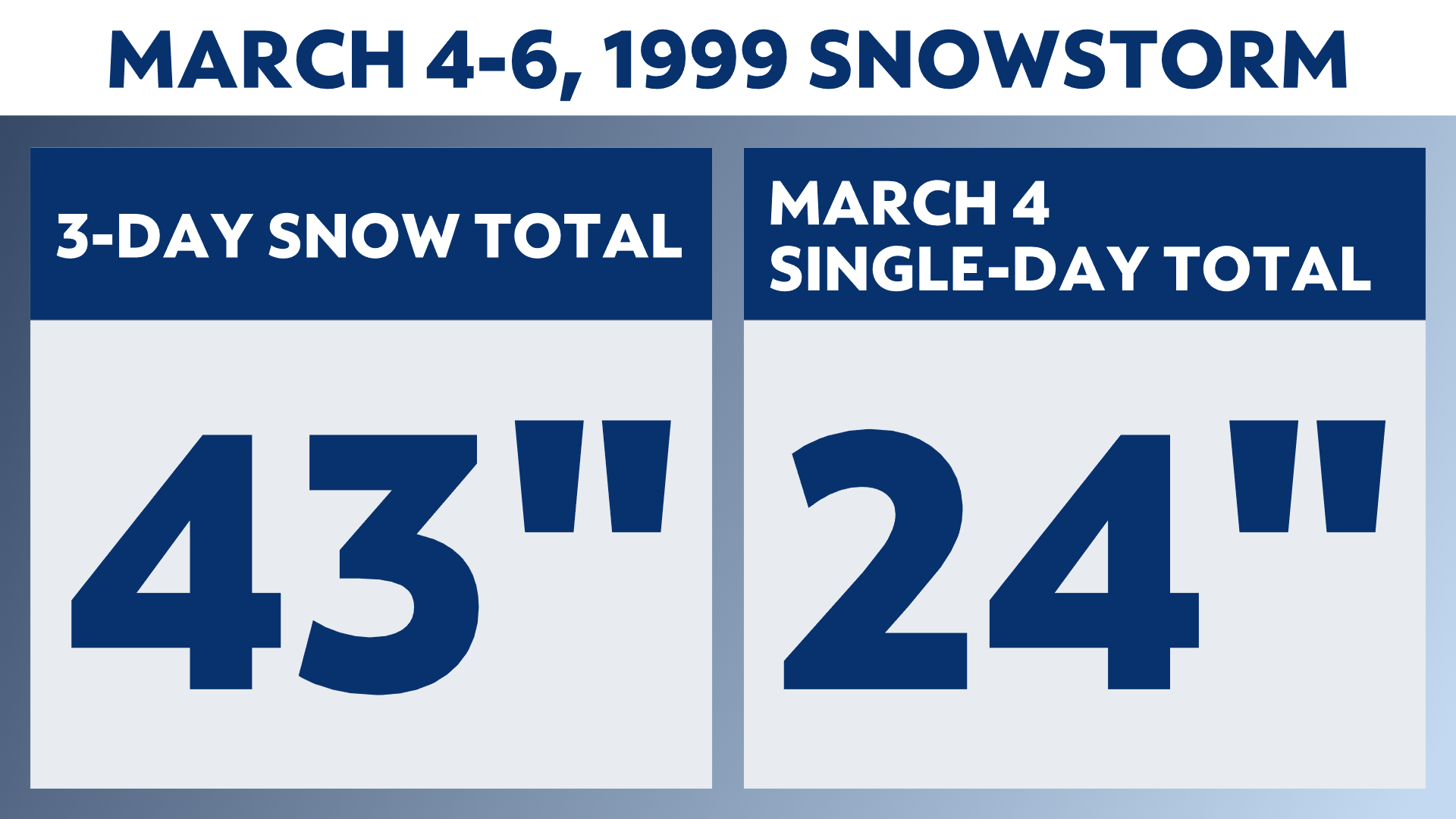
March 1999 stands as the third-snowiest March on record with the overwhelming majority of the snow for the month falling on those two days. We ended up with 45 inches for the month with about 43 inches falling on the 4th and 6th.
The 24 inches of snow that fell in Rochester made it the third-largest 24-hour snowfall in Rochester history. The all-time 24 hour record for Rochester is 29.8 inches set on March 1, 1900. March of 1900 also stands as the snowiest March on record at 54 inches.
The stage was set with strong low pressure moving up from the Plains across West Virginia sending some milder air and even heavy rain into our region on Wednesday the third.
Rain changed to snow just after midnight that Wednesday and then snow fell for nearly 14 hours straight.
The National Weather Service issued a Blizzard Warning for Rochester and surrounding areas, with blizzard conditions lasting nearly six hours!
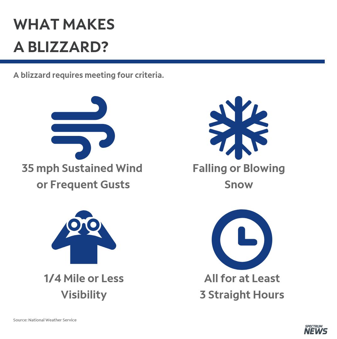
Three elements make up actual blizzard conditions:
- Sustained winds or frequent wind gusts of 35 mph or higher
- Visibility of less than a quarter-mile due to heavy snow falling and/or blowing snow
- The first two conditions must be forecasted for a period of three hours or longer

Snow fell at a rate of two to three inches an hour over this nearly six-hour period creating impassable roads all over the city. Interstates 390, 490 and 590 were all closed as was a lengthy stretch of the Thruway from Depew to Syracuse.
Cars were stranded on many roads in the city and suburbs, including on the Irondequoit Bay Bridge, and hundreds of cars on the Thruway.
Governor Pataki called in the National Guard who used Humvees to reach stranded motorists bringing them food and water and assisting ambulances to reach their destinations.
So many cars were stranded that it took an extraordinary amount of time for plows to clean roads up because the stranded cars had to be removed first.
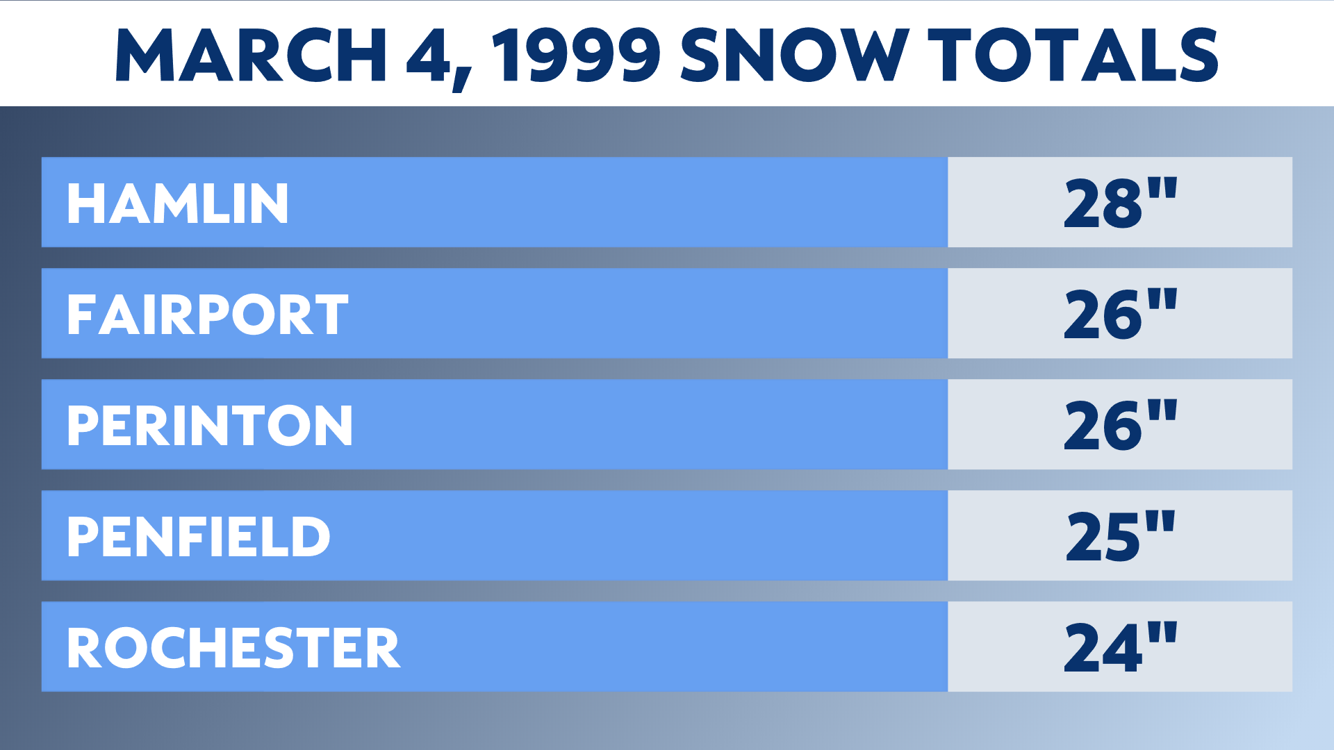
The final snow totals for this event included 28 inches in Hamlin, 26 inches in Fairport and Perinton, 25 inches in Penfield, 24 inches for Rochester and Ontario, 23 inches in Walworth and 20 inches for Webster and Greece.

We caught a break Friday March 5, allowing for the cleanup to continue while the arctic air settled over us kept temperatures in the 20s that afternoon with some sun.
That break didn’t last long as the next strong low pressure moved up from Ohio dumping another 6 to 12 inches of snow area-wide on Saturday March 6.
Lake enhancement played an important factor producing additional heavy snow accumulations for many areas north of the Thruway including in Rochester and the suburbs.
Nineteen inches of snow fell that day in Rochester, along with 18 inches in Fairport, Penfield and Ontario, 17 inches in Pittsford, with 16 inches recorded in Greece, Webster and Palmyra.
Needless to say, 43 inches of snow in Rochester over a three-day period created quite a mess.


