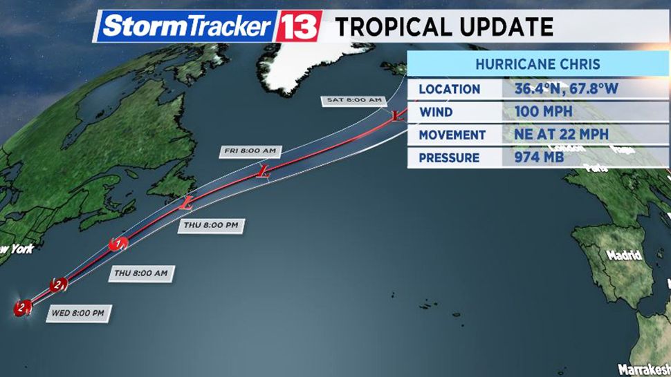
ORLANDO, Fla. -- Hurricane Chris has weakened into a Category 1 storm with winds of 90 mph.
- Hurricane Chris not expected to make U.S. landfall
- The remnant low of Beryl is pounding the Bahamas with rain
- TRACKING THE TROPICS: Spaghetti and forecast models, Gulf winds, satellite loops, watches and warnings and more
- STORM SEASON 2018: Supply kit info, emergency operations contacts -- everything you need to know to stay prepared before a storm approaches
Hurricane Chris

The storm is racing away from the U.S. East Coast. As of the latest advisory, the center was located 570 miles east-northeast of Cape Hatteras.
Hurricane-force winds are confined to 35 miles from the storm’s center.
The storm has picked up speed and is moving to the northeast at 25 mph. It is projected to continue its path parallel to the northeastern coastline. It is expected to continue to weaken.
As it loses tropical characteristics later this week, it will have impacts on eastern Canada including Newfoundland where up to 6 inches of rain may fall.
Chris is not projected to make landfall in the United States, but it will generate higher swells and rip current threats from the Carolinas up to the mid-Atlantic region over the next few days.
Meanwhile, the remnants of Beryl are producing heavy rain in the Bahamas. This disorganized cluster of storms will continue its path north, staying well east of Florida.
There is a moderate chance that these remnants may spin up again into something tropical later this week as it enters warmer waters.
Remnants of Beryl

Meanwhile, the remnants of Beryl produced heavy rain in the Bahamas. This disorganized cluster of storms will continue its path north, staying well east of Florida.
There is a moderate chance that these remnants may spin up again into something tropical later this week as it enters warmer waters.


